Our route crossed the Crown Range. As we climbed the zig zag into the mountains, we could see views back in the direction of Queenstown which was by now hidden behind an inconveniently placed mountain.


The Remarkables range of mountains could also be seen behind us.

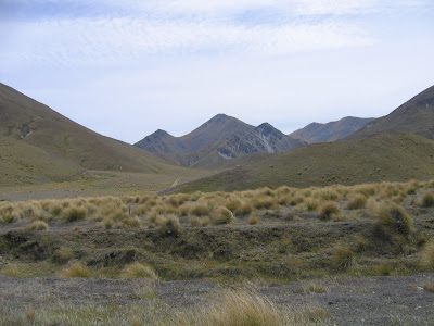
We didn't realise it at the time but we were heading into one of New Zealand's driest areas. It didn't take long for the hillsides to lose their green shade.

The views along the road were both beautiful and strikingly different to what we had seen so far.


I can only assume that the geological makeup was just as different from that we were leaving behind. I don't know what sort of rocks made up this terrain but I saw, at various times, what looked like limestone, sandstone, chalk and, finally, slate:

As we crossed the watershed and began descending towards Wanaka, the transformation in the landscape was nearly complete:

Here is a picture of Hannah showing her appreciation for all my geological musings:

When we arrived in Wanaka, the guy at the campsite complained about Wanaka's lack of rainfall and, after showing us to the best site in the place, put the sprinklers onto his parched yellow grass. Little did he know that, a couple of days later, the months long drought would come to an abrupt end.
No comments:
Post a Comment